Deformation Modeling Service
Interface to automatically generated deformation calculations (using Okada's method) from the USGS RSS feed for M>5 earthquake events.
Service Notice: disloc service is upgraded, please check out the sample event page and new tiltmap service products: Strain Maginitude and Slope
| |
||
Products for Major Earthquake Events
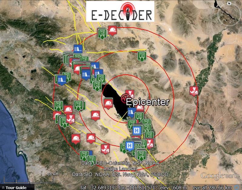
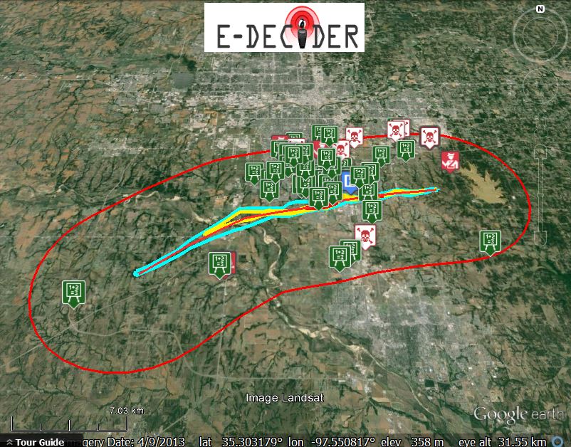
E-DECIDER produces special products for major earthquake events.
| |
||
Data Service API
E-DECIDER data service API provides RESTful web service APIs to enable downstream applications to access FEMA HAZUS data inventory and other QuakeSim/E-DECIDER products as informat of KMZ for Google Map and Google Earth, and GeoJSON for other online applications. RESTful APIs enable on-demand data request by user defined spatial query, it supports different incident types which can be defined as Point, Line and Polygon geometry.
If you are interested in testing data service, please contact us.
Examples:
-
Earthquake event for Great California ShakeOut 2012
dataservice_earthquake_googleearth_example.kmz
-
Tornado event: 2013 Moore Oklahoma Tornado
dataservice_tornado_googleearth_example.kmz
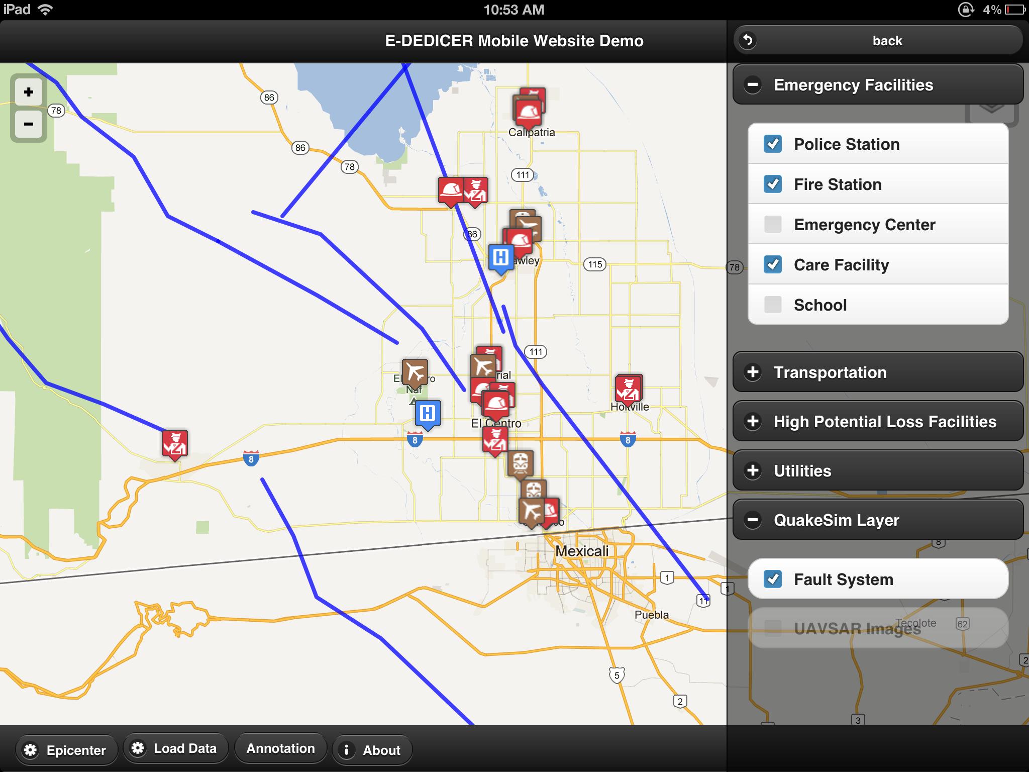
Mobile Interface
The mobile website serves as a technical demo to access large amount of geospatial data provided through E-DECIDER data service API, and this demo is specially tailored for tablets.
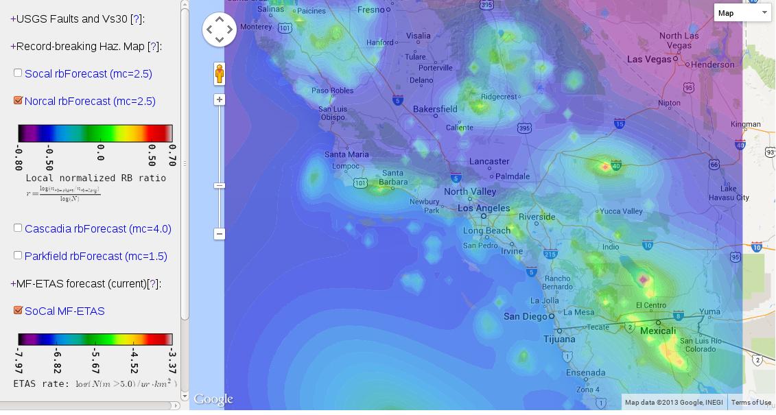
Seismic Hazard Maps and Forecasts
ETAS based forecast for which the spatial and temporal scaling parameters are estimated from earthquake spatial extents and scaling behaviors.
Visit E-DECIDER seismic hazard maps and forecasts